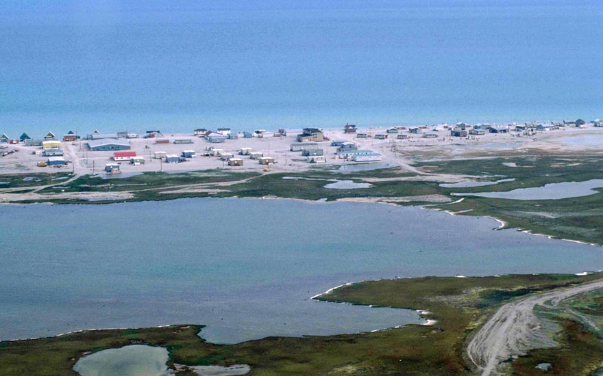
Kuujjuaq

kuujjuaq

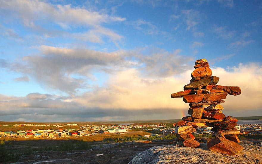
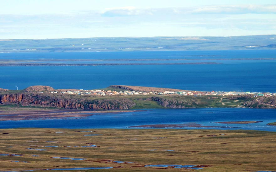
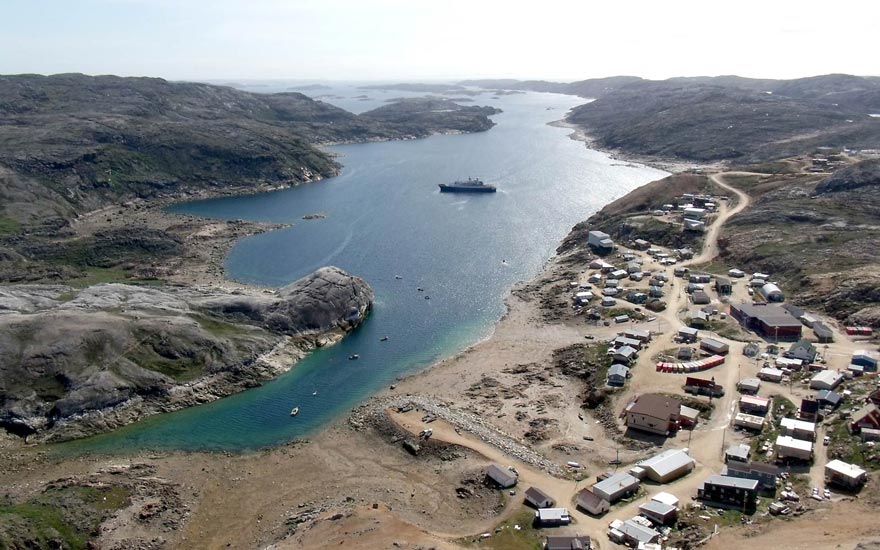
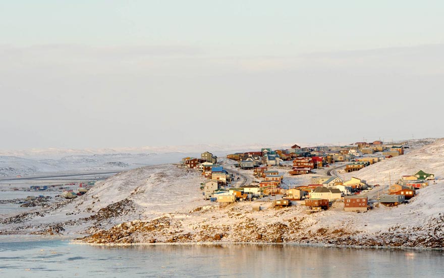
Kuujjuaq, Nunavik’s largest community, is located on the west shore of the Koksoak River, about 50 km upstream from Ungava Bay. Daily life in this community is closely tied to the mighty river. The ebb and flow of its tides are continually altering the landscape and they impose their rhythm on the practice of traditional summer activities.

The boreal forest is present around Kuujjuaq. Patches of black spruce and larch stand in marshy valleys. Kuujjuaq also witnesses annual migrations of the George River caribou herd. These animals pass through the region throughout August and September.

Kuujjuaq was known before by another name, that of Fort Chimo. ‘Chimo’ is a mispronunciation of the phrase saimuk, ‘Let’s shake hands!’ Early fur traders were often welcomed with this phrase which they eventually adopted as the name of the trading post.

The first Europeans to have contact with local Inuit were Moravians. On August 25, 1811, after a perilous trip along the coasts of Labrador and Ungava Bay, Brother Benjamin Kohlmeister and Brother George Kmoch arrived at an Inuit camp on the east shore of the Koksoak River, a few kilometres downstream from the present-day settlement. Their aim was to convert “the Esquimaux to Christianity.” According to the journal kept by Brother Kohlmeister, Inuit of the Koksoak River were very interested in having a Moravian mission in the area.

 Around 1830, the Hudson’s Bay Company (HBC) started the fur trade business in Nunavik by establishing their first post on the east shore of the Koksoak River, about 5 km downstream from the present-day settlement. The post closed in 1842, then reopened in 1866. At that time, Inuit, Montagnais and Naskapi came to trade at the post.

The construction of a U.S. Air Force base (Crystal 1) in 1942 on the west shore of the Koksoak River, the site of today’s settlement, and the occupation of the site by the American army between 1941 and 1945 sped up the development of the community. After the end of World War II, the United States turned the base over to the Canadian government. In 1948, a Catholic mission was established, followed by a nursing station, a school and a weather station. When the HBC moved upstream closer to the airstrips in 1958, it was followed by the remaining families that still lived across the river at Fort Chimo. In 1961, a co-operative was created.

 With its two airstrips, Kuujjuaq is the transportation hub of the entire region. The village boasts a number of hotels, restaurants, stores, arts and crafts shops and a bank.

Kugluktuk

kugluktuk

Kugluktuk will provide you with a unique Nunavut experience that is hard to forget. In the local Inuinnaqtun dialect, Qurluktuk means ‘place of moving water’, which is a very good description of a community tied closely to the magnificent Coppermine River. The landscape surrounding the community is much more temperate than most Nunavut communities. Kugluktuk provides, however, some of the best arctic experiences with wildlife viewing and a deep connection to cultural traditions. Incredible, accessible experiences await.

Essential Kugluktuk experiences include:

  • A trip to nearby Kugluq (Bloody Falls) Territorial Park to experience breathtaking landscapes and try your hand at fishing
  • Experience local history at the Kugluktuk Heritage Visitor Centre and Museum

Begin your Kugluktuk experience with a visit to the Kugluktuk Heritage Visitor Centre and Museum to receive a complete overview of the fascinating history and opportunities in the region.

The Inuit of Kugluktuk are Copper Inuit people, descendants of the ancient Thule people. They speak Inuinnaqtun – a closely related language to Inuktitut. The Copper Inuit was so named because they made arrowheads, spearheads, ulu blades, chisels, harpoons and knives form copper sources along the shores of the Coppermine River.

Kugluktuk is a stunning community located at the mouth of the Coppermine River. Steeped in history, Kugluktuk has been known as a cross-cultural meeting point for centuries. The area had been cohabitated by both Inuit and Dene First Nations people and there was long and complicated relationship between the two groups.

Kugluk Territorial Parks is a short trip away from Kugluktuk. Take a picturesque journey to see the stunning falls and spectacular shoreline.Once the site of a great massacre, it also became the setting for reconciliation in 1996, when the two groups participated in a healing ceremony.

The Inuit of this area made first European contact with Samuel Hearne in 1771. Samuel Hearne worked for the Hudson’s Bay Company and named the large nearby river the ‘Coppermine’. Local Inuit were known as Copper Inuit as they mined and used copper, an important resource for everyday life and trade. Kugluktuk Copper was found throughout the Arctic, traded from group to group.

Scientist and anthropologist, Diamond Jenness lived in the area, documenting the lives of Copper Inuit from 1913 to 1916. The Hudson’s Bay Company established a permanent post in 1927 and the RCMP outpost followed in 1932. In the 1950’s, the community began further development with the construction of a school, a nursing station, and a weather station.

Today you will find a community that is welcoming of visitors but still very close to the land. Wildlife viewing include many unique animals such as wolverines, falcons and hawks, caribou, muskox and moose.

Kugaaruk

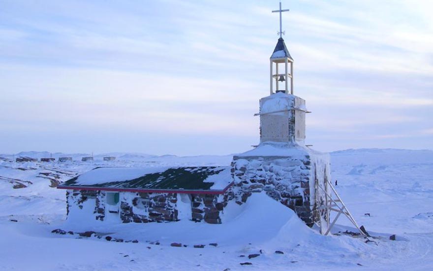
Stone church in Kugaaruk

The Inuit of Kugaaruk (Inuktitut for “little stream”) were amongst the last indigenous peoples in North America to have contact with Europeans in the latter part of the 19th century. Inuit have lived in the area for thousands of years as this was an important place for both caribou and sea mammal hunting. Local ice conditions, however, meant that it was difficult for traders, missionaries, and explorers to reach the area. Today, the community continues the traditions of their ancestors, pursuing a lifestyle that is not much different from a hundred years ago.

Essential Kugaaruk experiences include:

  • Travelling with expert local hunters on their treks for wildlife
  • Seeing the works and meeting the many fine artists who inhabit the community

Inuit have lived in the Kugaaruk area for thousands of years. Numerous archeological sites dot the landscape and add a sense of history to the area.

The unique environment makes Kugaaruk a challenging place for maritime transport. Often, many ships are unable to reach the bay. This is one of the few communities who rely on the Canadian Coast Guard icebreakers to bring in supplies. This unique environment allows you to experience sea ice almost throughout the year, giving you an amazing window on winter life and activities even during the summer.

The first Roman Catholic missionaries arrived in 1935 and a permanent mission was established in 1937. A stone chapel built in 1941 is being restored today by the community as an important historic site. Local Inuit continued to live a largely nomadic life until 1955 with the construction of a DEW Line radar site in the community. This brought the wage economy to the area, which led many Inuit to move into the community. Schools and a nursing station were constructed in the early 1960’s.

Today Kugaaruk continues to be largely tied to the traditional economy. Hunting and fishing remain important for providing food and clothing for local people. Within the past decade, there has also been a rise in mineral exploration, with numerous gold and diamond exploration camps located within a 150 km radius.

Kimmirut

kimmirut

If you are looking for the heart of Nunavut, look no further than Kimmirut, which means “the heel’ in Inuktitut, a reference to the shape of a hill near the community.

Sitting at the mouth of the Soper Heritage River where it drains into the Atlantic Ocean, this small, tight knit community of 425, is surrounded by stunning scenery and abundant wildlife. The people continue to have a deep connection with Inuit culture. You will experience what life was traditionally like in most Nunavut communities in modern day Kimmirut.

Essential experiences include:

  • Visiting nearby Katannilik Park  ideal for hikers, paddlers, and dogsledders
  • Exploring the unique local arts scene at Soper House, with its array of intricate carvings, tapestries, and jewellery
  • Viewing the wonderful array of nearby marine mammals, including polar bears, whales, seals, and walruses

The people of Kimmirut have had contact with Europeans longer than most Inuit in the Qikiqtani region. After thousands of years of living in the Kimmirut area, Inuit contact with Europeans began in the late 1600s. The rise of the Hudson’s Bay Company brought traders into the area transiting throughout Nunavut.

The first permanent buildings in Kimmirut were erected in 1900, when the Anglican mission opened. The Hudson’s Bay Company built the region’s first trading post in 1911 and the RCMP followed with a station in 1927. The construction of the school in the late 1950’s and a nursing station brought many Inuit off the land to settle in the community.

Today, you will find a community still thriving on the traditional economy. Skilled artists, while not as well known as their cousins in Cape Dorset, craft magnificent carvings, wall hangings, and jewellery – much of whom use gemstones unique to this area. Soper House, run by the Quliruakut Arts and Craft Society, displays and represents the work of local artists and craftspeople. Hunting provides much of the local diet and is the cornerstone of this traditional economy. Polar bears, beluga, caribou, seals, and birds are all visible within the area.

For many modern day explorers, a visit to Kimmirut is not complete without a  trek through the nearby Katannilik Park. Visitors are wowed by the journey down the Soper Heritage River, known in Inuktitut as Kuujjuaq or ‘the great river’. The Soper River that bisects the park is on the bucket list of many paddlers from around the world.

A visit to the Katannilik Territorial Park Visitor’s Centre will provide you with a complete overview of what is seasonally available, and help you connect with a qualified guide.

The proximity of Kimmirut to the nearby City of Iqaluit makes Kimmirut ideal for people seeking an experience of traditional Nunavut life.

Iqaluit

iqaluit

Canada’s newest capital will provide you with a fascinating glimpse of the Nunavut territory and its ever-changing culture. The bustling capital is a modern Inuit community, home to Inuit people from around the Territory as well as proud newcomers from around the world. Set along the spectacular hills of Frobisher Bay, Iqaluit (Inuktitut for ‘Place of Many Fish) is a sparkling jewel in Nunavut’s crown.

Some essential Iqaluit experiences:

  • Explore nearby Qaumaarviit Territorial Park  and learn about the thousands of years of local Inuit history
  • Hike through beautiful Sylvia Grinnell Territorial Park, located within the Iqaluit city limits, and then relax in one of the excellent dining options in town
  • Explore the vibrant arts scene: public carvings and graphics are incorporated into the buildings and landscape throughout the town, galleries display local and territorial arts and crafts, jewellery, and local made clothing. The Legislative Assembly incorporates Inuit motifs in its modern design and showcases Inuit treasures, and the Nunatta Sunakkutaangit Museum curates displays of art representing artists throughout the Territory.

Iqaluit is an accessible destination and will give you an excellent taste of Nunavut’s culture and history. Walking through the beautiful community you will be delighted with the stunning vistas of mountains and sea ice, and can catch a glimpse of what makes Nunavut so special. Home to people from around the world, you may encounter a famous Inuk artist dining at the Lebanese restaurant or catch a visiting Hollywood celebrity at the local museum.

Iqaluit boasts many fine hotels and restaurants, where you can relax after a hike through the Sylvia Grinnell Park or to Apex Beach. There are hiking trails for people of all abilities that will lead you to the untamed beauty of the arctic tundra.

The city is home to many famous Inuit artists, and their work can be found at several local galleries. Iqaluit’s artists not only excel at traditional artmaking, but also draw inspiration from the influx of newcomers to the area, creating a truly modern and vibrant art scene.

The annual Alianait Festival in late June/early July brings together musicians and artists from around the North and welcomes artists and performers from around the world. Music, theater, circus acts, storytelling and visual arts are all featured. The festival also produces a concert series throughout the year.

In the spring, you can experience the Toonik Tyme Festival, and see the community celebrate the end of a long winter. The games and activities bring the residents of this small city together, creating and warm and welcoming environment.

There is much to see and do in the Nunavut capital. In and around Iqaluit, four territorial parks  offer a variety of cultural and wildlife experiences for you. Historical buildings, such as the original Hudson’s Bay Post on the shore in Apex are also within easy reach.

For the nature buffs, local outfitters can take you on an amazing experience ‘“down the bay’” and out to the floe edge where you will encounter whales, pods of seals, and perhaps even one or two wandering polar bear. The stark contrast of leaving a bustling community and finding yourself lulled by the silent breaths of a hard-working dog team will tug at your soul.

The history of Iqaluit is unique. While Inuit have lived, fished, and hunted in the area for millennia, the modern history of the city began with the establishment of the Iqaluit Airport – a part of the staging route for American aircraft being delivered to Europe during the Second World War. In Iqaluit you can still see some of the remaining buildings left behind

Checking in with the Unikkaarvik Visitor’s Centre will provide you with the latest up to date information on the various seasonal activities that are available. This centre is conveniently located next to the Nunatta Sunakkutaangit Museum, allowing you to place this wonderful city in a historical context.

Inuvik

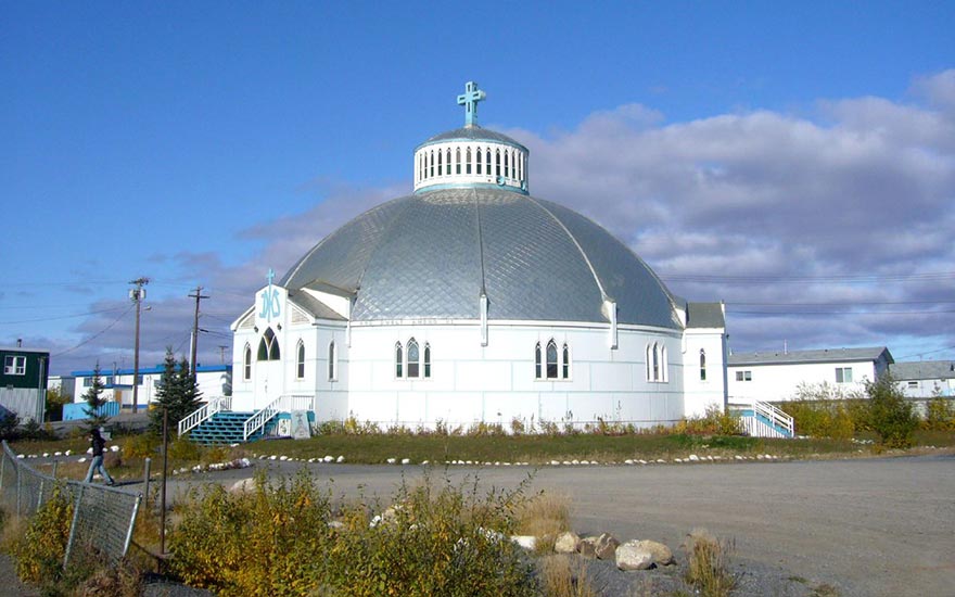
Igloo Church, Inuvik, NWT-- the most-photographed building in the town

Inuvik is located on the east channel of the Mackenzie Delta, and is the administrative centre for the Inuvik Region of the Northwest Territories, and currently holds the distinction of being the northernmost Canadian community captured by Google Street View. Inuvik is also the annual host of the Great Northern Arts Festival.

Igloolik

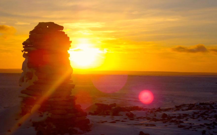
igloolik sunset

Millions of people from around the world were captivated by the stark beauty of the Igloolik area through the award-winning films of Igloolik-based Isuma Productions. These films tell many stories of Inuit life and the connections with Europeans, but what they subtly showcase is the tremendous cultural knowledge of the people that reside in Igloolik- hunters, storytellers, keepers of traditional knowledge. When you visit Igloolik you feel as you are entering the spirit of Inuit culture.

The Iglulik is an Inuktitut phrase meaning ‘there is a house here’, which refers to ancient sod houses that have been found in the area. It is this ancient connection that provides you with a wealth of experiences, including:

  • Learning about the deeply rooted Inuit culture and language,
  • Visiting ancient Inuit campsites, used for over 3,000 years ago
  • Exploring the diverse surrounding ecosystem with walruses, whales, polar bears, caribou, and seals.

In Igloolik, you can walk through ancient campsites that Inuit have used for over 3000 years. Local Inuit were amongst the last people to have regular contact with Europeans and have managed to maintain a very strong sense of identity and culture.

Centrally located between the Canadian mainland and Baffin Island, Igloolik has long been a crossroads for Inuit in Nunavut. Igloolik Inuit had extensive trading and cultural contacts with other Inuit from Baffin Island, the Kivalliq, and the Kitikmeot regions. The Igloolik area represented an important element of circumpolar trade.

Igloolik is often considered a cultural centre of Nunavut. The film, Atarnarjuat was produced and directed by local filmmaker Zacharias Kunuk using local actors and costume designers. This film depicted life before contact with Europeans and went on to win numerous awards, including the Golden Camera award at the Cannes Film Festival. This monumental work broke a trail for other local filmmakers and actors, and Igloolik has become a ‘Hollywood’ of Nunavut.

Igloolik is also home to the world-renowned ‘Artcirq’ modern circus, which blends Inuit culture and modern circus techniques. Each year Artcirq performs at the hamlet’s Rockin’ Walrus Arts Festival.

Hay River

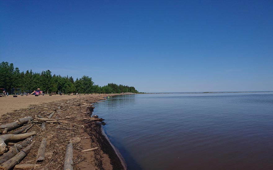
Hay River beach

Hay River is known as the “hub of the North,” located on the south shore of Great Slave Lake in the Northwest Territories.

Sanirajak (Hall Beach)

hall-beach

Called Sanirajaq, meaning ‘the shoreline’, the Inuit of Sanirajak (Hall Beach) have enjoyed and benefitted from the abundance of marine life, including walruses and beluga whales for thousands of years.

The hamlet itself dates to the Cold War era and the primary interaction local people have had with the outside world is through the arrival of the military. Here you can find the physical remains of the Cold War and the role that Inuit played during those times.

Essential experiences in Sanirajak:

  • Exploring the history of the Cold War through military installations in the community
  • Viewing polar bears and walrus, fishing for arctic char, and learn about the ways that Inuit have adapted to the physical challenges of being in close proximity to the sea
  • Spotting migratory birds (jaegers and gyrfalcons, geese, and ducks) and arctic birds (snowy owl and ptarmigan)

Here, in the shadow of Cold War radar installations, local Inuit continue the centuries long tradition of fermenting walrus meat on the shoreline. This juxtaposition makes for an interesting experience for visitors. In the fall months, this fermenting walrus meat attracts polar bears, while they wait for the of sea ice to form before beginning their winter-long march in search of seal.

The Inuit of Sanirajak will welcome you into their lives, which in many ways remain unchanged from centuries old traditions. You can travel with these expert hunters on their hunts, or travel by snowmobile or boat to nearby Igloolik, taking in the many marine mammals that are nearby. On April 1 every year, Sanirajak marks the return of continuous daylight from April to August with Hamlet Day, a festival featuring a community feast, traditional games and dancing.

Sanirajak is home to a multitude of migratory birds, and is an area that is exhilarating for birders and photographers alike. The haunting calls of loons and the cry of jaegers and gyrfalcons echo across the tundra. Geese numbering in the tens of thousands make the annual trek back to Sanirajak, along with ducks and snowy owls.

Military history buffs will be fascinated by the signs of sixty years of Cold War radar and intelligence gathering equipment. Sanirajak was a lonely but important sentinel facing the Soviet threat over the North Pole, and you will feel that you have stepped back into these tense and exciting times.

Gjoa Haven

gjoa-haven

Gjoa Haven is located on the southeast coast of King William Island at the heart of the Northwest Passage. It is also called Uqsuqtuuk which means ‘place of plenty blubber’ in Inuktitut. The name Gjoa is named after Norwegian explorer, Roald Amundsen’s ship during his expedition through the Northwest Passage. While docked there over the winter, he noted that it was ‘the finest little harbour in the world’.

In 2015, after years of fruitless searching researchers acted on the oral traditions of the Inuit of Gjoa Haven and found the remains of Sir John Franklin’s ill-fated 1845 expedition. They found the remains of his two boats, the HMS Erebus and the HMS Terror preserved in the arctic waters off Gjoa Haven. You too can take part in this epic search that shaped much of modern day Nunavut. In Gjoa Haven you can speak with the holders of Inuit oral tradition and add your name to the centuries old list of arctic explorers.

Essential experiences in Gjoa Haven include:

  • Exploring the Northwest Passage Territorial Trail and see how this community is central to the ongoing saga of the passage
  • Seek out a true arctic wildlife experience, looking for caribou, muskox, and migratory birds
  • Experiencing a vibrant, welcoming Inuit community

History

Gjoa Haven is a community that is closely tied with the saga of the Northwest Passage. Its storied history includes contact with Scottish explorer John Ross and his crew in 1829 who were trapped in ice. It was because of the assistance of the local Inuit that they survived. Gjoa Haven was also the location of the ill-fated John Franklin expedition in 1845. John Franklin and his crew perished without ever finding the Northwest Passage.

It was Norwegian explorer, Roald Amundsen who founded ‘Gjøahavn’, noting it was the ‘finest little harbour in the world; He successfully traversed the Northwest Passage as the first explorer in 1906 due in large part to the local Inuit people who taught him how to survive in the Arctic.

The permanent community was founded after the Hudson’s Bay Company opened a trading post in 1927, which was followed by Roman Catholic missionaries. In the 1950’s, the population was only 110 people but has grown steadily with the establishment of schools, a nursing centre, and other essential services.

Activities

The Northwest Passage Territorial Trail will provide you with an amazing overview of the ancient and modern history of Gjoa Haven. You will see the signs of how Inuit once lived in the area, and how their interaction with the land continues today.

Today the community is a vibrant one, and still closely connected to the history of the the Northwest Passage. It is a popular destination for Arctic history buffs.