Norman Wells

Norman Wells

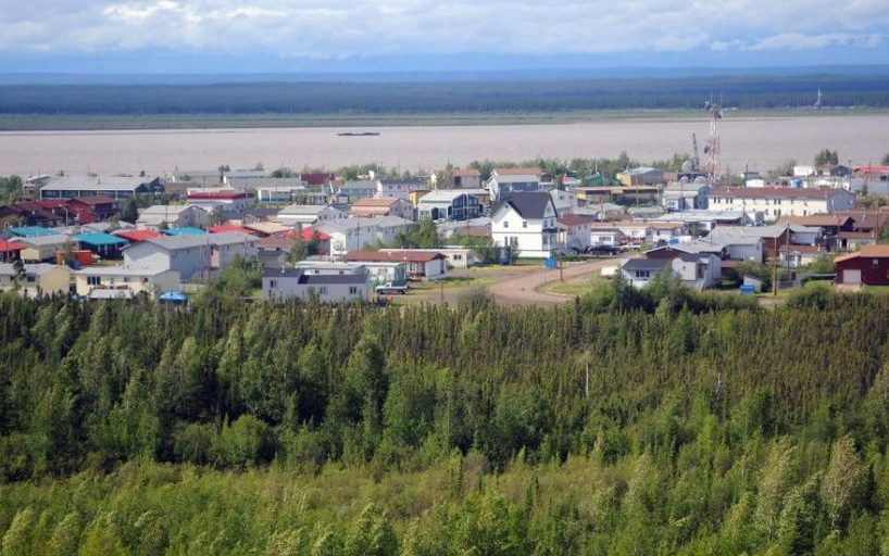
Norman Wells is an historic town of about 800 nestled between the Mackenzie River and the Franklin Mountains. Its traditional name, Tlegohli means “Where There is Oil,” which makes sense given the town was established in 1920 with a small oil refinery. This largest Sahtu town is the governmental, industrial and transportation hub of the region and the place to launch innumerable Sahtu adventures.

This is the place to embark on an epic paddling adventure on world-class rivers. Norman Wells offers access to sixteen river systems by air from this fly-out outfitting centre.

Be sure to check out the incredible views offered by the hiking trails in the nearby Franklin Mountains, or dig for fossils in the aptly named Fossil Canyon to see what existed in the Sahtu in ancient times. Or, if you’re up for a big back-country expedition, Norman Wells is the place to launch a trek along the Canol Trail – known as the toughest hike in North America.

As the aviation hub of the Sahtu, it is also THE place for flightseeing tours. In the span of as little as 90 min, you can check off numerous gems of the Mackenzie Mountains. Don’t forget your camera!

Source : Spectacular Northwest Territories

Yellowknife

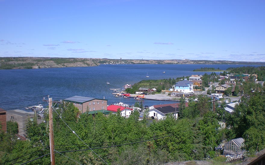
Looking across Great Slave Lake towards the Yellowknife Yacht Club and Giant Mine

Yellowknife, located on the north shore of Great Slave Lake, became the centre of economic activity in the North after gold was found in the area in the early 1900s. Gold production waned mid-century, but the presence of diamonds has rekindled the city’s mining industry. Yellowknife hosts many cultural events and festivals year-round.

Ulukhaktok

ulukhaktok

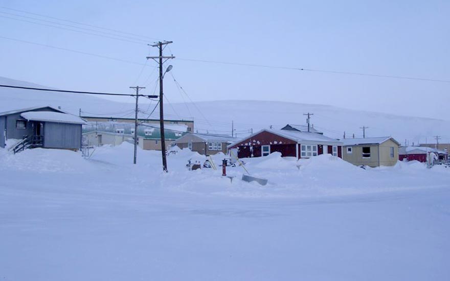
Ulukhaktok is a hamlet on the west coast of Victoria Island, in the Inuvik Region of the Northwest Territories. Its economy centres around fishing, hunting and trapping, but printmaking has recently become a major source of income for its citizens. It is also the home of the world’s northermost golf course, hosting the Billy Joss Open Celebrity Golf Tournament annually.

Taloyoak

Taloyoak

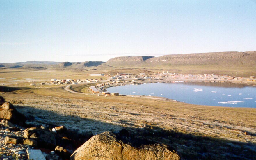
Taloyoak (Inuktitut for ‘Large Caribou Hunting Blind’) is a unique community, defined by the strength of the people and the ruggedness of the land. Formerly called Spence Bay, Taloyoak provides you with glimpses into Inuit culture and wildlife. The name Taloyoak refers to screens built with piled stones along the caribou migration routes. Muskox are found nearby and the area is renown for its arctic char fishing.

Essential Taloyoak experiences:

  • Wildlife viewing of polar bears, caribou, whales, seals, muskox and migratory birds in a stunning environment
  • Fishing for ‘green’ and sustainable arctic char
  • Seeing how the women in the community handmake ‘packing dolls’ – arctic animals dressed in duffel amautiit (traditional parkas) carrying their young on their backs

Taloyoak is the northernmost community on the Canadian mainland. Ruggedly beautiful, there is an impressive rock formation to the north that some consider similar in appearance and impact to Ayres Rock in Australia.

Taloyoak has been an important place for Inuit for thousands of years, tracing the people’s origins to the Thule people. With ready access to both caribou and sea mammals, Taloyoak has a vibrant culture that is closely tied with the land.

Sewing is a vital part of traditional and contemporary Inuit culture. The handmade packing dolls from Taloyoak reflect and draw on a rich and complex culture that is over 4,000 years old. Based on the traditional sewing skills of Inuit girls and women, ‘packing dolls’ were first designed by Peeteekootee Ugyak (Charlie) in Taloyoak. A distinctive feature of all the packing dolls is the ‘babies’ carried in the parkas. This reflects the Inuit tradition of ‘packing’ babies in a mother’s amauti – a unique mother’s parka with a special pouch (or ‘amauti’).

The John Ross expedition in 1831 located the North Pole Magnetic with assistance from the people of Taloyoak. Later, between 1848 and 1860, British explorers made contact with the Inuit in the area while searching for the lost John Franklin expedition. Sir John Franklin and his crew disappeared while searching for the Northwest Passage, and in the years following numerous explorers attempted to retrace his path through the Taloyoak area.

The community of Taloyoak was founded in 1948 when the Hudson’s Bay Company built a trading post. Local Inuit of this area were amongst the last to settle into a community in the 1950s when schools were established and Catholic and Anglican missions opened churches.

Wildlife viewing opportunities include seasonal access to polar bears, caribou, seals, migratory birds, and beluga whales.

Today the community is still tied closely to the land and animals. The local economy is very much based on hunting and trapping.

Resolute Bay

Resolute Bay, Nunavut, Canada

Resolute Bay is one of the most fascinating communities in Nunavut. Because of the long winter night in the extreme north of Nunavut, its Inuktitut name is Qausuittuq meaning ‘place with no dawn’. Located on Resolute Bay, it was a critical junction along the Northwest Passage in the 18th and 19th centuries. It was named for the British ship, HMS Resolute, abandoned in 1850 while searching for the Northwest Passage and the lost Franklin expedition.

The community of Resolute was started much later, by the military in response to a growing threat from Russia after the Second World War with the forced relocation of Inuit from Northern Quebec. Resolute has evolved into a meeting place for a wide range of scientists and an eclectic mix of extreme adventurers who use the community as a launching point for their work

Essential experiences include:

  • Wildlife viewing: Polar bears that frequent both the community and area, and beluga whales, seals and walruses in the nearby waters, as well as migratory birds
  • Exploring the interesting history showcased in its buildings and Cold War era plane wrecks that are located nearby.
  • Trekking through Tupirvik Territorial Park’s ancient seabed rich with fossils dating back 400 million years

The community of Resolute Bay highlights an interesting chapter in Canadian history. The Canadian Government, under growing pressure from the United States and Russia’s territorial claims in the high arctic sought to establish communities to strengthen Canada’s claim to the area.

Families were relocated under false pretenses to move from Northern Quebec to Resolute Bay in 1953. The Canadian and American militaries had already established a weather station and airport in the present location and needed to expand civilian presence.

You will be able to experience this history first hand as you explore the community. Crashed WWII era aircraft, buildings that once housed top secret machinery, and the signs of military presence are all still available for viewing. You will also need to take care in your exploration as it is common throughout the summer and fall to see polar bears wandering throughout the community.

Today, you will notice a surprisingly modern and cosmopolitan oasis in the High Arctic. The airport is an important staging point for High Arctic research, tourism, and military activities. The community has diversified beyond the early military beginnings and is now a destination for eco adventure tourism.

Resolute Bay is a jumping off point to truly spectacular experiences. Whether you are going to hike Quttinirpaaq National Park, explore the remains of century old RCMP posts, or take part in an expedition to the North Pole, you will likely spend some time in this unique community.

Resolute Bay Airport is a hub for charter flights throughout the rest of the High Arctic, shuttling not only researchers and scientists to their field camps but also eco adventurists to Quittinirpaaq National Park, Ellesmere Island, and Grise Fiord . For aviation buffs, the Resolute airport is home to many legends of Canadian aviation. Pilots who fly their deHavilland Twin Otters to 700-foot gravel bars, to sea ice fuel caches that move 16 kms per day and to the geographic North Pole are a unique and capable bunch.

The community does not see the sun for months on end, and then the sun does not set for months. This creates a beautiful and sometimes haunting environment where the mountains and hills seem to surround the community. Inuit today are masters at extreme hunting, able to capture important food and animals in the long winter darkness.

Rankin Inlet

rankin inlet

Rankin Inlet, also known as Kangiqtiniq in Inuktitut meaning ‘deep inlet’, is a modern and vibrant community that is a blend of cultures and traditions. This mixture of Inuit and European culture, the old and the new economy, and the blending of Inuit from many tribal backgrounds led to a generation of prominent leaders that started the movement towards creation of the Nunavut territory.

Some essential Rankin experiences include:

  • Boating to Marble Island, located 50 kilometers by boat from town, and learn about the history about this  culturally significant site. The island is steeped in mythology and tradition and teeming with polar bears and beluga whales during the summer and fall seasons
  • Touring the local art scene. Rankin Inlet has a unique history of pottery carried on by the grandchildren of the first Inuit who tried their hands at ceramics in the 1960s. The Matchbox Gallery showcases the true ‘Rankin Inlet esthetic’ and the dedicated artisans who continue the tradition. Ivalu, a retail and arts studio, showcases both local artists and those from other regions of Nunavut. You can also find artists developing their work outside their houses – carvers and jewellers alike.
  • Exploring the ancient Thule Inuit site at the Meliadine River at Iqalugaarjup Nunangat Territorial Park. This was the ancient site of Inuit occupation, where you can still enjoy fishing at the river,- known for its excellent grayling fishing and crystal clear drinking water.
  • Skating in the home arena of local hockey hero and NHL star, Jordin Tootoo

Rankin Inlet is the gateway to the Kivalliq region, and the many riches it has to offer. Travel by dogsled or snowmobile to see the iconic animals of the Arctic. The great caribou herds make their annual migration across the rolling tundra. The powerful nanuq – the polar bear- silently prowls the shores of Hudson’s Bay. The rivers and lakes nearby teeming with arctic char, grayling, ake tTrout.

These were the  natural treasures that first drew people to the Rankin Inlet area over 2500 years ago. The early Inuit established deep routes and honed strong culture traditions on the stark tundra. Over time, Europeans in search of whales and a passage to the Far East discovered the wealth of the area. Some of the earliest contact between the two cultures took place at Marble Island, 50 kms away from Rankin Inlet where whalers established an overwintering camp on the protected harbours of the island.

European whalers were followed by trappers, traders, and explorers seeking adventure and profit. Inuit in the area learned to communicate with these visitors and have been welcoming to this day.

Rankin Inlet has been shaped by the discovery of nickel during in the early 1950s and the establishment of the North Rankin Nickel Mine at the current town site. Walking through the community today, you can see the remains of the mine – the rock crusher that stands where the headframe once rose from the land.

The mine brought Inuit from around the region seeking the first wage employment their families had ever seen. These were followed by traders and government officials who helped shape the local economy and develop the community today. Mining continues to be an important pillar of the community with the development of the Meliadine Gold Mine 40 kms away.

Rankin Inlet continues to be a meeting place and a hub for the region. All flights to the Kivalliq pass through the bustling Rankin Inlet Airport. The welcoming people of this community are proud to showcase their  culture and traditions that are expressed through art at local galleries.

Follow in the footsteps of local hockey hero Jordin Tootoo and lace up your skates at the local arena, and observe firsthand the determination of young players seeking to be the ‘Next One’. The arena is a pillar of the community and is open to public skating for all ages with skates available to borrow. Also, coming out to watch the intense local hockey leagues in action is always a thrill.

Qikiqtarjuaq

qikiqtarjuaq

Located at the northern entrance to Auyuittuq National Park, Qikiqtarjuaq is a welcoming and picturesque community. Qikiqtarjuaq is the Inuktitut word meaning ‘big island’. This cheerful community is nestled on the ocean amongst small mountains.

The people of Qikiqtarjuaq are experts at navigating the challenging seas and rugged landscape. You will experience the patience of the people that comes from years of those who live off the land. Waiting for ideal weather or the tides to subside with grace and humour, will leave you wanting to spend more time in this wonderful location.

Essential experiences include:

  • Exploring the splendor of Auyuittuq National Park: Mount Asgard, Mount Thor and the dramatic Pangnirtung Pass ice cap
  • Diving aside magnificent icebergs
  • Viewing bowhead, narwhal, and orca whales, as well as walruses and seals

Many visitors use Qikiqtarjuaq as the starting point for their trek through Auyuittuq National Park. An abundance of sea life – migratory birds, whales, seals, and polar bears populate the area. Expert local guides can share with you their experience on how to get the most out of the Auyuittuq experience, imparting knowledge that will help you on your journey.

Local outfitters also provide transportation and interpretive services for visitors wishing to fish in the area. You will see hunters returning from their hunts with an abundance of food for their families. You will see fisherman returning with full catches of arctic char and turbot.

Qikiqtarjuaq is also strategically located for iceberg viewing: the northern cape near the town captures many of the icebergs that travel down Davis Strait from Greenland making this an excellent location to see icebergs as they begin their movement south.

History

With its strategic location facing Baffin Bay, the military built a radar site near the current community of Qikiqtarjuaq. This vital station was a part of the Distant Early Warning (DEW) line, which monitored the movement of aircraft in the arctic. In 1962, there was a mass movement of Inuit from nearby Kivitoo after a tragic drowning. Inuit sought the refuge that the military base provided. As with other communities with these DEW Line ties, you will find that local Inuit are welcoming to visitors and knowledgeable of the outside world.

This traditional community has much to offer. There are traditional sealskin parkas and boots (kamiit) as well as arts made here. And there are the memories of the warmth and beauty of this special place that will last a lifetime.

Pond Inlet

Pond Inlet

Pond Inlet (Mittimatalik- Place where Mitima is buried) is renowned for its scenery. Located at the eastern entrance to the Northwest Passage on the Eclipse Sound and overlooking famous Bylot Island, mountain ranges are viewable in all directions and icebergs often dot the ocean.

Pond Inlet provides you with intimate access to marine mammals such as narwhal and beluga whales, migratory birds, and polar bears. Pond Inlet also has unique trips for those seeking something different – bicycle atop the sea ice and parasail above gigantic glaciers. This is the perfect spot to indulge your arctic fantasies.

Essential experiences:

  • Exploring the incredible beauty and splendor of nearby Sirmilik National Park, by dogsledding, snowmobiling, boating, or skiing
  • Walking through the community and meeting the people whose strong cultural values continue to thrive in everyday life, and attending a performance by the Tununiq Arsarniit Theatre Group
  • Discovering the floe edge, glaciers, explorable ice caves and scenic fiords

Named Mittimatalik (place where Mittima is buried) in Inuktitut, no one knows for certain who is Mittima, but he is believed to be buried here.

The local area is teeming with wildlife. Pods of seal as well as beluga, narwhal, bowhead, and orca whales  all frequent the floe edge. Hundreds of thousands of migratory birds occupy nearby Bylot Island. The scenery, the wildlife, and the friendliness of the people of Pond Inlet have made it a “must see” destination in the Arctic.

This wildlife, mixed with the stunning scenery are the reasons that eco adventurists  visit nearby Sirmilik National Park. The park holds unparalleled adventures for those looking to explore the sea, the mountains, and the floe edge.

Inuit have occupied the area for over 1000 years and were joined by the rush of whaling ships from the United States and Europe in the 1800s. Unusually, the first trading post in Pond Inlet was not opened by the Hudson’s Bay Company, but rather by private Scottish investors in 1910. In 1912, both the Anglican and Catholic churches founded missions in Pond Inlet. The Hudson’s Bay Company later opened a trading post in 1923.

Pond inlet is the home of the Tununiq Arsarniit Theatre Group. This original Inuit theatre group was founded in 1987 and has been developing and performing for over 20 years. The group develops its plays and performances by consensus, involving elders as actors and writers. Inuit language, culture, legends, myths, and the wisdom of the elders are central to all the plays developed.

Today, Pond Inlet is the largest community in Northern Baffin Island, and enjoys excellent infrastructure and air transportation links. Nearby Sirmilik National Park and Tamaarvik Territorial Park are unforgettable experiences.

Pangnirtung

pagnirtung

Nowhere else in the Arctic is the absolute majesty of the land, and the rhythms of Inuit life as accessible as Pangnirtung. Also known as Pangniqtuuq in Inuktitut,meaning ‘place of bull caribou’, it is the southern community gateway to Auyuittuq National Park.

Nicknamed ‘Pang’, the community is situated in a fiord on a beautiful mountain terrain. Savour the moment to take in the breathtaking beauty of the towering mountains and glaciers at Auyuittuq National Park and the vertical cliff of Mount Thor. When you wake up in the morning in Pangnirtung, it will take a moment to believe that your view of the mountains and the sea is actually real.

Essential experiences:

  • Journeying to the dramatic, pristine landscapes in Auyuittuq National Park, the backdrop for the opening scene of the James Bond thriller, ‘The Spy Who Loved Me’
  • Exploring Kekerten Territorial Park and learn about the area’s connection with turn of the century whalers
  • Visiting the Uqqurmiut Centre to see the famous artists at work and then shop for the lithographs, prints, sculpture, and tapestries created here
  • Getting one of the famous ‘Pang hats’

Pangnirtung, the gateway to Auyuittuq National Park, has so many layers that you will enjoy peeling back. For outdoor enthusiasts, view Mount Thor,  the world’s tallest vertical drop at . In addition to this, however, Pangnirtung is also home to thriving art scene, a major commercial fishery and people who are deeply proud of their culture and traditions.

Pangnirtung has been occupied for over 4000 years. Inuit have long used the Pangnirtung area as important hunting and fishing ground and this tradition continues today. Known for abundant sea mammals such as seals and whales, Pangnirtung is also an important player in the Nunavut economy, exporting wild turbot around the world.

Whalers chasing bowhead whales made contact with Inuit in the early 1800s. A whaling station was established at nearby Kekerten Island in 1840 and there was a large commercial whaling operation up until the early 1900’s. Walking through the community you will see signs of this history by the shore – the old Hudson’s Bay Company ‘Blubber Station’ remains today. The white washed buildings shine brightly against the blue sky and sparkling ocean.

In 1921, the Hudson’s Bay Company established a trading post, which was followed in 1923 by the opening of a Royal Canadian Mounted Police office. In 1929, St. Luke’s Mission Hospital was founded in Pangnirtung – a first for Baffin Island.

A must see for any visitor is the Uqqurmiut Centre. A hub for local artists, the Uqqurmiut Centre is home to world famous tapestries that beautifully depict the land and the people. Printmakers who are known around the world, diligently work on collections each year. You  can also purchase a famous “Pang Hat”, a warm, crocheted hat that will immediately give you ‘street cred’ throughout the Arctic.

Pangnirtung is the gateway not only for Auyuittuq National Park, Mount Thor and the hikers on the ‘Pang Pass, but also Pisuktinu Tunngavik Territorial Campground and Kekerten Territorial Park. The incredible scenery of Pangnirtung was the backdrop for numerous films and documentaries – notably for the opening scene of the James Bond thriller ‘The Spy Who Loved Me’.

But you don’t have to be James Bond to have the experience of a lifetime in Pangnirtung. You will need, however, a desire to see the best the Arctic has to offer, and the curiosity to explore a deeply historic and special location.

Ottawa

The Parliament of Canada

Ottawa is Canada’s Capital, located on the shore of the Ottawa River in Ontario. It was named the world’s 3rd cleanest city in 2010 and features the scenic Ottawa River Parkway. Tourist attractions in Ottawa include museums and galleries, Parliament Hill, and the Ottawa Senators hockey franchise.